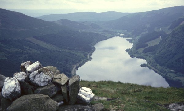
The ridge is moated on almost every side by impenetrable conifer forest, however a break in the defences on the east allows easy, albeit rough, access from the right of way through Glen Ample. It was worth the diversion to the south top with its small cairn for the full length view down the loch which is not even glimpsed from any other point on the ridge. Apart from this view the most spectacular moment is on Creag a'Mhadaidh, foxes crag, where ancient landslips have left crevasses on the side of the hill now filled with luxurious vegetation, thick heather and bilberry predominating.
The grassy summit is a splendid viewpoint westwards, with Ben More and Stobinian prominent and northwards to Ben Lawers and the Tarmachans. Ben Vorlich and Stuc a'Chroin are disappointing from this side however although a visit to the north top separated them more and improved this prospect. We had a splendid day for this hill, warm and later quite sunny although a haziness obscured the views to some extent.
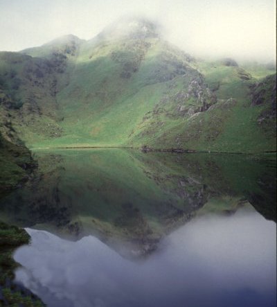
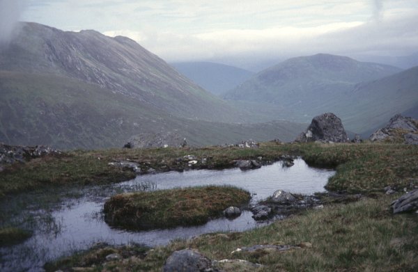
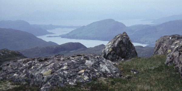
Glas Bheinn lies amongst these higher hills doing its best to look imposing. In fact from this glen it appears the finest for it displays its steep eastern coire on this side. The more southerly bridge was swept away, a few planks scattered in the river, but the one on the path was in fine condition and gave us access to the watersmeet with the easily crossed Allt Tarsuinn which made a lovely lunch spot. As the map suggests the ridge is unexciting but it was sufficiently well defined to give a pleasant climb to the cairn from which we had a unique full length view of Loch Arkaig and a distant panorama of the beautiful hills around its western end. We varied the return by continuing along the ridge until the gradient westwards eased and allowed a simple traverse to the track down the Allt Dubh.
[Loch Arkaig from Glas Bheinn]
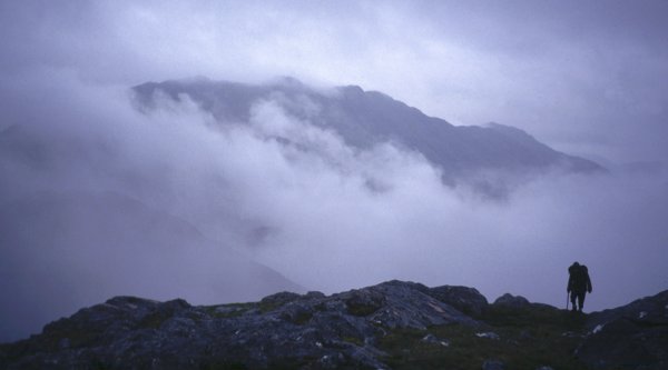
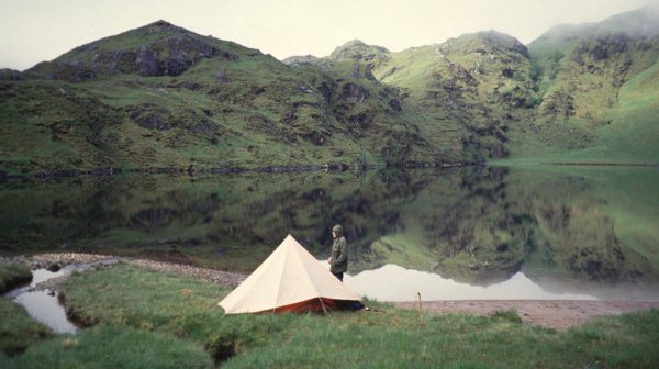
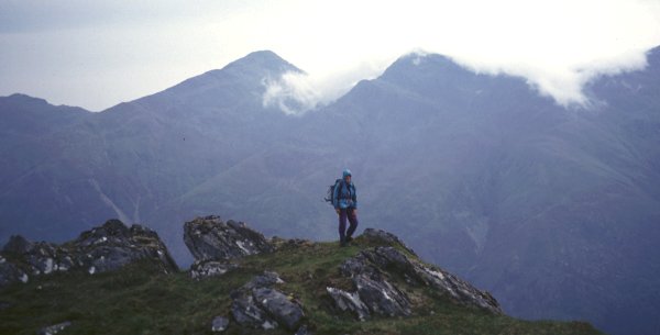
We pitched the tent at the most northerly twist of the River Barrisdale and tackled the steep slopes onto Meall nan Eun. Mist was on the top but not thick enough to prevent us seeing the little lochan which lies just below the higher eastern top. We could also just see the west top which no doubt gives magnificent views towards Ladhar Bheinn but in the mist and with daylight now short we turned straight down the way we had come. The mist had thickened considerably however and the careless navigation of those who think it easy just to retrace a route led us into doubt and confusion before we finally made it down the unpleasantly steep southern flanks to the tent.
[Slat Bheinn from Meall nan Eun]
9/6/93
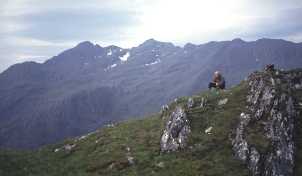
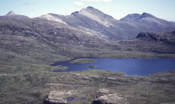
Next morning it was misty still as we packed up and continued over the col to Loch an Lagain Aintheich where we pitched the tent again so that we could deposit most of our gear for the tough ascent of Slat Bheinn. The lochan was totally calm and the mist was rising from the hill giving it a far more dramatic aspect than it had when we returned later in brilliant sunshine. [picture]
Our first problem was crossing the stream running out of the lochan which was deep and muddy. A quick diversion downstream seemed to offer no hope so instead we waded through the loch near the outlet, a process which plunged us deeper than it appeared so that the trousers were wet up to the crotch. Fortunately it was a warm day and they dried without too much discomfort.
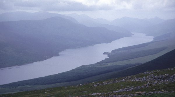
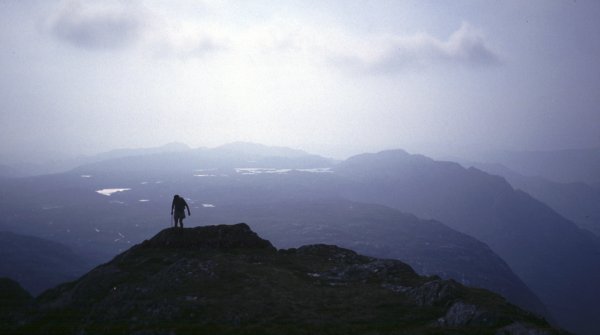
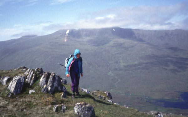
The climb was steep and rocky in places over a number of little false craggy tops but with the mist lifting slowly off the hills it was thoroughly enjoyable and from the top we had the view of Ladhar Beinn which we had missed from yesterday's summit. Also conspicuous was the Corbett Sgurr a'Choire-bheithe, a hill which I would love to climb again since we travered its interesting east ridge in thick mist. It could be incorporated into a splendid circuit with Slat Bheinn but this was not possible today with the tent awaiting us below.
On the return we diverted only a little south and found an easy crossing of the infant Abhainn Chosaidh. Back at the beautiful lochan we cooked a leisurely lunch in the sunshine to give us the energy for the long hard pack out round the shores of Loch Quoich and back to Kinloch Hourn and the end of a very satisfying expedition.
[Slat Bheinn from Loch an Lagain Aintheich] . [Ladhar Beinn from Slat Bheinn]
It was a very beautiful day with a sea of cloud piling up in the north and lapping up the slopes of the more westerly hills. To the east however it was perfectly clear and my next hill, Meall a'Chrathaich could be seen beyond the reservoir Loch Liath. Rowland had climbed it before so he returned to the bike and drove the car along to Bhlaraidh. The summit of Carn Mhic an Toisich lies right at the eastern end of a long flat ridge so I was immediately faced with a sharp drop and a quick decision as to whether to take to the boggy shores of the loch or make the extra reascent over Carn na Caorach. I chose the latter, probably a wise choice although even this failed to avoid the bog entirely as I approached the dam at the outlet from Loch Liath. The track fords the river below this dam and the crossing looked extremely hazardous with the water running high and fast across a sloping and slippery slab of concrete. The dam itself could not be walked across but I managed to find a way through between it and the point where the river gushed out of a large pipe although this involved an awkward climb up a wall encased in wire fencing. This minor problem overcome I now faced a very boggy approach to the south ridge of the mountain which again was quite dry and pleasant in its upper reaches.
The mist rolling up from the north was approaching at about the same speed as I was climbing. I was engulfed in it as soon as I arrived at the trig point and it persisted as I descended very steeply eastwards and worked my way across to the northeast corner of Loch a'Chrathaich. The shore was too stony here for comfortable progress so I took to the bog alongside but further along the beach gave very pleasant walking on hard packed peat. As I approached the dam the banks became steep and rough but progress was made most pleasantly by an enjoyable traverse along the steep rocks which form the banks of the reservoir in this section.
Near the dam was a waterworks vehicle so I knew it was going to be easy walking down to the road. This would have been a better approach for cycling than the one from Dundreggan. A striking feature of this descent was an insignificant hill to the east on which a radio mast stood above the mist throughout my descent while the hill itself remained under a white blanket of cloud.
[Loch Chrathaich from Meall a'Chrathaich] . [Meall a'Chrathaich from Loch Chrathaich]
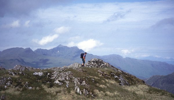
Unfortunately the ridge loses it connoiseur character further down and becomes broad, grassy and even boggy in places. It has a sting in the tail however, as it approaches Sheil Bridge, in the form of smooth slabs. I failed to negotiate a satisfactory way along the ridge and had to scrabble down an undignified escape route to the side. Perhaps an ascent would have been more feasible. Certainly it is worth the effort to arrange a traverse of this interesting ridge.
[The Five Sisters ridge from Biod an Fhithich] . [The Saddle from Biod an Fithich]
It was quite late in the day and so we had those lovely westward views of lochans glinting in the sunlight which are so common on summer evenings in the Highlands and which always give a special delight. We contemplated a descent to Bealach na Sroine but were put off by the rough and boggy looking nature of the terrain, so although we came down the south side of the hill we just swung back westwards and rejoined our outward route above the forest.
[on Carnan Cruithneachd] . [Carnan Cruithneachd from Iron Lodge]
I had walked here before in the other direction when making an escape to Iron Lodge after an aborted backpack further north. We spent a whole day at Bealach Bearnais in torrential rain and when it was still pouring down next morning decided to escape via Loch Monar to the emergency rendezvous at Killilan. By the time we got to about here the sun had come out and we were faced with the long trudge down Glen Elchaig without the assistance of a bicycle.
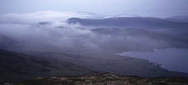
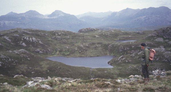
Loch Mhoicean is unusual on the map as it apparently drains in both directions. Certainly there was water flowing out southwards but unfortunately we did not think of checking it at the northern end. Eventually we left the track to slant up to the col below An Cruachan and then struggled up the very steep southern slopes of this hill to its neat and tidy cairn. Here we spent some time for the wind was dropping and this is certainly a spot to linger if possible for it is one of the remotest summits in the Highlands.
Conditions now were excellent and the visibility was good although all the higher summits were capped with cloud. Lurg Mhor drew our gaze particularly, stirring happy memories of our visits to this mountain, one of the hardest to get at of all the Munros.
Eventually we left this lovely summit, setting off eastwards and then dropping into the northern corrie to avoid the very steep gradients in every other direction. We joined the stalkers path and followed it through some very boggy sections to the bothy Maol-bhuidhe in its wonderfully wild and remote setting above Loch Cruoshie. On the western side the walls of the bothy formed a delightful suntrap in which to enjoy afternoon tea before the long climb back over to Iron Lodge.
The cycle ride back to Killilan was pure delight with both wind and gravity on our side, the perfect ending to a very satisfying long day.
[An Cruachan from Carn na Breabaig] . [Lurg Mhor from An Cruachan] . [An Cruachan summit]
To reach the higher top, Creag Dhubh Mhor, we had a steep and rocky descent to the most attractive col where we passed between the two largest lochans to gain a similar steep slope with little rocky outcrops to negotiate to reach the summit. This top had very similar and equally magnificent views as its lower neighbour with the eastern mountains now more conspicuous and Bealach Bearnais, where I had once spent a very wet day marooned in the tent, looking only a stroll away.
We descended onto the stalkers path, swinging eastwards enough to avoid the black crags which give this hill its name and which are rather more extensive and dramatic than the map suggests. We left the path lower down to take a look at the waterfall Eas an Teampuill which falls into a deep and spectacular gorge well worth the short diversion.
All in all an excursion to be highly recommended, but one best saved for a clear day, partly because this hill would be very confusing in the mist but mainly because it is one of the finest viewpoints in Britain.
[the Torridon hills from Creag Dubh Mhor] . [Loch Carron from Craig Dubh Mhor]
We took the stalkers track round the east side of the hill as far as Loch an Eoin where we enjoyed lunch in the sunshine watching a diver with its tiny chick on the loch. Unfortunately the binoculars had been left in the car so we could not get a good look at this shy bird.
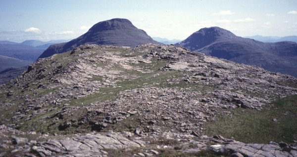
The southeast ridge of the hill is quite steep with a combination of slabs, boulders and grass. Where possible, in these dry conditions, the slabs gave the best going. The summit is above all a viewpoint for the higher hills, with Beinn Alligin and Liathach to the north seen in profile but not perhaps at their most striking with the sun beating straight on to them giving a flat aspect very different from the feel one would have on climbing these mountains. The eastern hills, Beinn Liath Mhor, Sgorr Ruadh and Maol Chean-dearg looked more dramatic showing their steepness to great effect from this angle, particularly in retrospect on the way up the ridge.
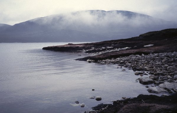
We descended southwestwards to Drochaid Coire Roill, with Beinn Damh towering up ahead, and came down the stalkers path. The river crossing had defeated us in the past, a nasty trap for the unwary coming down this way in times of spate, but today it was low and peaceful and we enjoyed a paddle for our tired feet in its cool waters.
[Beinn Eighe from the ridge] . [Maol Chean-dearg and An Ruadh-stac from the ridge]
 my homepage