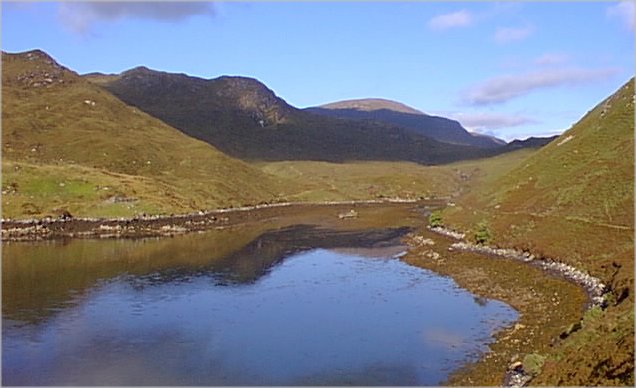
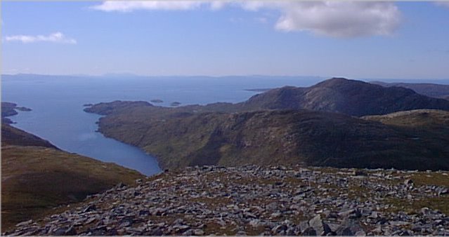
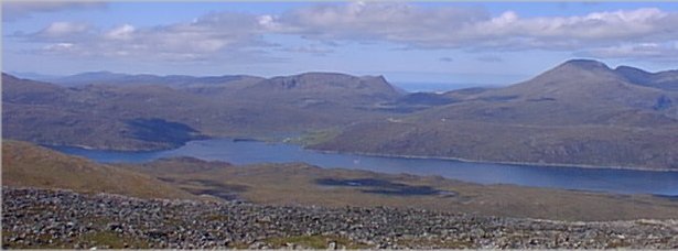
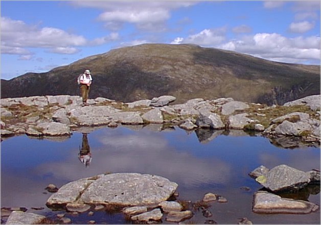
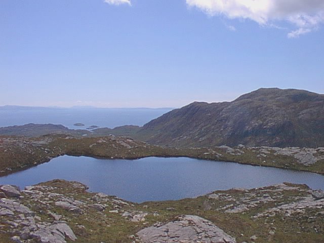
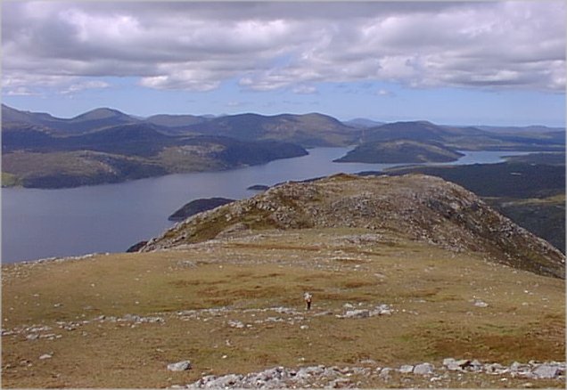
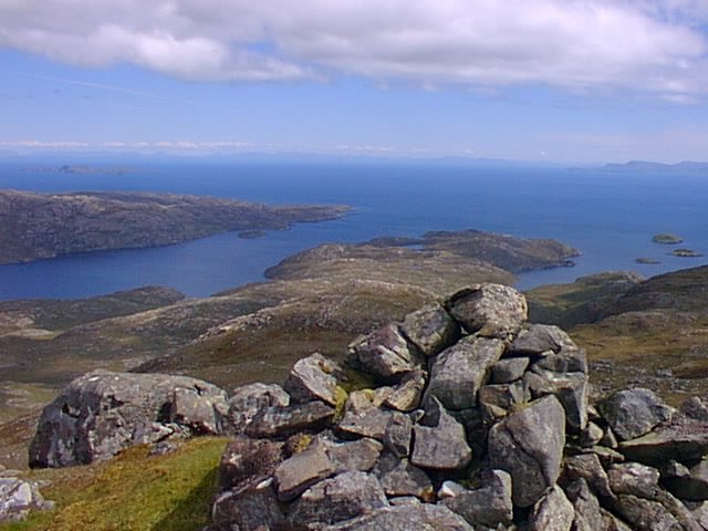
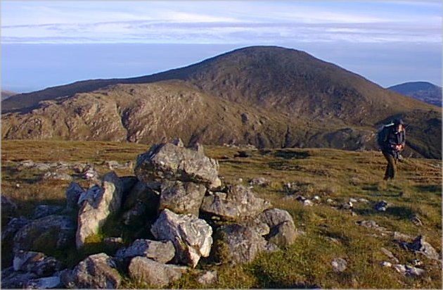
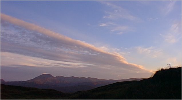
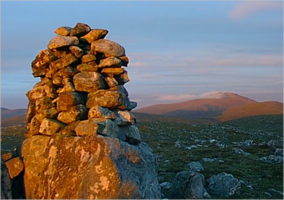
A good track, not hinted at on the OS map, runs west from Eishken to the good bridge at the head of Loch Sealg [picture 1]. It continues into the valley east of Beinn Mhor, where it terminates abruptly at a weather vane. This totally unexpected feature in an otherwise empty landscape carries a weatherfish rather than a weathercock. From here we worked our way up onto the south-east ridge of Beinn Mhor which at 572m is the highest hill in this area, the Pairc peninsula. From the stony summit we got our first glimpse of distant Caiteshal [picture 2] and a splendid panorama westwards to Sgaoth Aird and Clisham, the highest mountain in the Western Isles [picture 3]. The south-west ridge gave very easy walking to Carn Ban whose cairn was unexpectedly surrounded by dozens of old car tyres. Then a steep descent took us onto the ridge of Cipeagil Bheag which is actually higher than nearby Cipeagil Mhor and is in the Marilyn list. Its summit is a area of rock and rock pools, a very pleasant spot for lunch on this warm and sunny day. From this top we looked back to Beinn Mhor [picture 4] and forward to our next and furthest summit [picture 5].
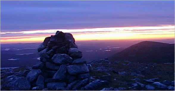
Now followed another big descent and reascent onto the north ridge of Caiteshal [picture 6]. We felt later that we could have got there more easily by passing south, rather than north, of Cipeagil Mhor. Given lots of time and energy an even more enterprising approach would be to follow the south ridge of Cipeagil Bheag right down to the coast and come up the south ridge of Caiteshal! Anyway we were happy to get there by any route and we sat for a long time enjoying just being in this remote and beautiful place. We were certainly lucky to be here on such a splendid afternoon [picture 7]. The Shiant Islands were conspicuous out to sea eastwards while Toddun looked deceptively close across the now invisible Loch Seaforth.
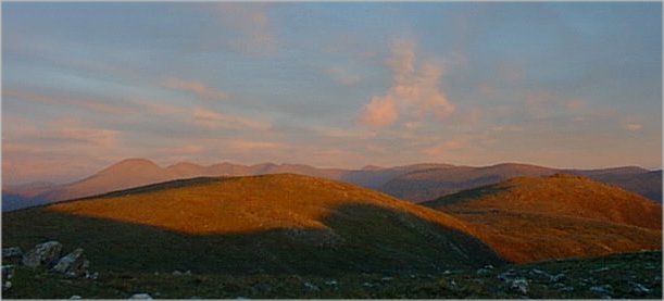
At last we dragged ourselves away from this delectable spot and retreated along the north ridge. Then began a long traverse around the west side of Beinn Mhor. Even in this perfect clear weather it was not easy to keep on the best contour to avoid both unnecessary reascent and the deep clefts of streams running down the hillside. These streams were not to be avoided altogether though, since they provided welcome water on what was now a very hot afternoon. It was quite late when we reached the col to the north of Beinn Mhor where a decision had to be made. If we now went straight down the valley to Loch Sealg we reckoned that we would reach the good track by dusk. However it was a beautiful evening and we had carried the bivi bags all day so we decided to continue onto Muiaithabhal and spend the night in the hills [picture 8]. On the col north of Muaithabhal an unpleasant cold wind had sprung up and it was difficult to find a flat and sheltered spot to settle down for the night. We lay huddled in the bivi bags watching the sun set behind Clisham [picture 9]. By 3am we were awake, cold and anxious to get moving. The climb onto Guainemol brought welcome warming and from the cairn we saw a multitude of lochans catching the first glimmers of light from the sun which was still below the eastern horizon [picture 10]. By the time we had walked to the cairn on Mor Mhonadh it was bathed in early morning sunlight with Beinn Mhor wreathed in a wisp of cloud [picture11]. The ridge we had just followed was backed by Clisham, already in bright daylight [picture12]. By the time we had descended into the exceedingly boogy valley of the Abhainn Sgeiraval and walked back on the quiet road to the car, it had turned into a gloomy morning with spitting rain. We reckoned ourselves lucky indeed to have completed this exceptional walk in such superb weather.
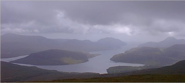
Please click on a picture to see a full sized version. The final shot was taken a few days later on Liuthaid. Looking south along Loch Seaforth the distant hills are Beinn Mhor, Cipeagil Bheag and Cipeagil Mhor, Caiteshal and, on the west of the loch, Toddun. Closer is Seaforth Island whose 217m summit is another Marilyn [picture13].
 my homepage
. . . . . . . . . . . my Scottish page
my homepage
. . . . . . . . . . . my Scottish page